Category: Research

Family research

Friday Finds: FamilySearch Wiki

In looking for information about Roxburghshire, Scotland I came across the FamilySearch Wiki information on Scotland. This site includes information on all the Scottish counties, including information on available records (census, court records, civil registration, etc.), maps, and its parishes. The parish pages will tell you about the records available for that parish, including church and civil records.

I found it quite informative—especially the list of parishes in each county and the parish information. The pages also point to another site I’ve used successfully—Scotlands People (the Scottish Records Office)—to find census, birth, marriage and death records.

It also points to a site that has UK census records online—for free! I found my ancestor William Bonnington in the old town of Galashiels in Selkirkshire in the 1841 census. It doesn’t give you an image to view like Scotlands People does, but it will show you the household and its associated information. You can click to view the previous or next household if you want to see more about the neighbors. The data is not 100% for every county for every census, but there is a page to see the database stats for each.

Friday Finds: Scottish Maps

One of the joys of browsing other genealogy blogs—besides getting ideas on how to organize information, which always intrigues the designer in me—is finding new goodies to help my research. So, hat’s off to Kathleen Moore for finding and posting two helpful maps of Scotland in her blog “The Misadventures of a Genealogist”.

The first is a map showing the locations of the various Scottish clans. The only surname I recognize from my family is Buchanan, shown just to the north of the Highland border line, northwest of Glasgow. My Buchanans seemed to have been miners and were located in Shotts in Lanarkshire.

Scottish Clan map

Scottish Clan map (src: Geneawiki)

The second map shows the administrative subdivisions in Scotland. The majority of my Scottish ancestors lived in Lothian (East, West & Mid), Lanarkshire, and parts of the Scottish Borders.

Scottish Administrative Subdivisions

Scottish Administrative Subdivisions (src: Wikipedia)

Do You Know Your Family Health History?

We’ve all heard how diseases can now be predicted by blood tests that search our DNA for specific markers, thus proving that a lot of the most common ailments run through our family lines. Tracing your family’s medical history for illnesses that have affected your parents, grandparents and other relatives can tell you something about the possibilities for your future health. Even the Surgeon General has a campaign—the Family History Initiative—to encourage Americans to learn all they can about their family health history.1

So, how can you go about it? The best way to start is simply to ask family members. Some information may be kept private, but folks will usually talk about the most common illnesses—heart disease, high blood pressure, cancer, and diabetes—or the medications they or family members are taking. Try to get information on family members as far back as you can. Write this information down to share it with your doctor.

Where else can you get health information, especially for relatives your family never knew? Death certificates.

Elmer Greulich Death Certificate Medical Information

Elmer Greulich’s cause of death

We all know death certificates can be helpful in identifying the names of a previous generation—the parents of the deceased. But these documents also provide information on the cause of death and contributing factors. While the cause of death is important, the contributing factors may actually tell you more about the state of your relative’s health.

For instance, the death certificate of my ancestor Elmer Greulich lists his cause of death as a “coronary occlusion.”2 This is a blockage of a coronary artery, which may cause a heart attack. Fairly common. The contributory causes include hypertensive arteriosclerosis and cardiovascular disease, present for 10 years. Not a big surprise given his cause of death.

However, they also include “diabetes mellitus.” This is a major piece of family health information—especially since cardiovascular disease can be caused by diabetes. Knowing that diabetes is present in your family is an important piece of information to share with your doctor. Untreated it can cause all types of nasty damage to your body and lead, ultimately, to death. Given Elmer’s age at death—66—it is more likely that he had type-2 diabetes. Type-1 diabetes left untreated would have probably killed him much younger.

I’ve also learned that some scientists believe that if your mother has type-2 diabetes, you’re more likely to get the disease.3 Elmer’s mother died of gangrene of the foot.4 Diabetes can cause reduced blood flow or lack of circulation, leading to “dry gangrene”. 5 At this point, I’ll probably never know for sure if she had diabetes, but the possibility is there. It’s certainly worth learning the cause of death for her other children, or possibly her siblings.

Obituaries can also provide information regarding a relative’s health. Elmer’s obituary states that he was “partially blind the last four years and in ill health for several years.” So, it is likely that his death was the result of diabetes as changes in vision and blindness can be long-term effects of the disease.6

Where have you found family health history information?

How Many Henry Hoobers in Martic Township?

So, just how many Henry Hoobers were there in the Conestoga (now Pequea)/Martic (now Providence)/Lampter/Strasburg township area of Lancaster County, Pennsylvania? If you’d asked me that question yesterday, I’d have said one. Now today, I’m not so sure…

Hoover land patents in Conestoga/Martic Township area

Diagram I: Hoover land patents in Conestoga/Martic Township area

According to the township warrantee maps, there were 5 tracts either warranted to or patented to Henry Hoober in the area where Martic (now Providence), Lampeter and Leacock (now Strasburg) townships meet. [see B1-5 on diagram] They were:

  • B1: 86 1/2 acres warranted to Henry Hoover 24 Jan 1733, patented to Joseph Bosler 28 Mar 1810, Patent Book H2:272
  • B2: 144 acres warranted to Michael Shank, 27 Sep 1717, surveyed 4 Jun 1718, and patented to Henry Hoober 15 Apr 1740, Patent Book A9:180 (Copied Survey Book D82:15)
  • B3: 106 acres warranted to Michael Shank, 27 Sep 1717, surveyed 4 Jun 1718, and patented to Henry Hoober 15 Apr 1740, Patent Book A10:97 (Copied Survey Book D82:48)
  • B4: 68 acres warranted to Henry Hoober 14 Apr 1740, surveyed 10 Nov 1731, patented 15 Apr 1740, Patent Book A9:178 (Copied Survey Book C76:15)
  • B5: 171 acres warranted to Henry Hoover 13 Nov 1744, surveyed 20 10ber (Dec?) 1744, Patent Book AA1:227 (Copied Survey Book A46:77)

In 1733, Michael Shank sold his rights to 250 acres at the junction of Pequea Creek and Big Beaver Creek to Henry Hoober and Jacob Good [tracts B2 & B3 in the diagram]. Henry Hoober took the northern portion and Jacob Good took the southern portion. Jacob Good’s last will & testament, dated 12 Sep 1739, named Henry Hoover as his son-in-law; his daughter was not named.1 There is also a last will & testament for Henry Huber of Martic Township, dated 7 Aug 1757.2 Jacob Huber, son of Hans Huber and owner of tracts A1-A3, named his “loving friend Henry Hoover” as one of the executors of his estate in his last will & testament, dated 9 Jul 1759.3

In 1758, John and Elizabeth (Hoover) Boyers sold their share of the property they had inherited via Henry Hoober’s last will & testament to John Hoover, the other heir to the property. This tract of land was patented in Patent Book A9:180—tract B2 in the diagrams.4

Martic Township Hoover property

Diagram II: Martic Township Hoover property

In 1767, Henry and Catharine Hoober sold to their son John Hoober two tracts of land in Martic Township.5 The first tract was 88 acres from the tract patented in A10:97 or B3 in the diagram. [see left] The second tract was 171 acres from the tract patented in AA1:227 or B5 in the diagram.

Also in 1767, Henry and Catharine Hoober sold to Jacob Hoober 3 tracts of land in Martic Township totaling 137 acres.6 Mapping it out, Jacob Huber’s property matches the residue of tract B3, B4 and part of B5 from Diagram I or B4 on Diagram II. These deeds, to the best of my knowledge, were not recorded until his executors—possibly his sons—sold the land in 1790.

Based on this information, it becomes apparent that there were two men named Henry Hoober—quite likely father and son—living in the Martic Township area circa 1740 at the time the tracts were patented. The elder Henry (?—1757) had children John, Elizabeth, and quite likely Henry Jr. He may have had more. Henry Jr. [the younger], who married a daughter of Jacob Good—quite possibly Catherine as seen in the deeds, had a son John and and possibly another named Jacob to whom he deeded land in 1767.

Henry Jr. may have also had a son-in-law named George Feite. His name appears in the metes and bounds for one of the tracts sold to John Hoober on the boundary for tract B5 (B8 on the diagram). Additionally, the name Ulrich Hoober appears as a neighbor (to the south) in the metes and bounds for tracts B4 and B5 sold to Jacob and John Hoober, respectively. He may have been another relative of Henry Jr.

Tract B6 and B7 also belonged to Hoovers. Tract B6 was warranted to Martin Huber 6 Apr 1803 and patented to him on 13 Nov 1811. Tract B7 was warranted to Jacob Huber 14 Mar 1796 and patented to him on 12 Apr 1803. These two men could have been grandsons of Henry Hoober Jr. or Jacob Huber. If at least part of B7 belonged to Ulrich Hoober at one point, he must not have patented it.

As always if you have additional information or questions on any of the people in this post, please contact me or leave a comment.

Making a Deed Map from Old Metes and Bounds

As you may know I’ve been working with land records a lot recently. I started with the surveys available for Lancaster County land warrants and patents, grouping them by township and name. I’ve also been going through Hoover family deeds for Lancaster County and assigning them to the appropriate Hoover family. My goal is to tie the deeds not only to a particular Hoover family, but also to a particular tract of land back to the original patentee. Sometimes, the information is readily available in the deed itself; sometimes it requires some backtracking through deeds.

As part of the process, I’ve been trying to create deed maps for deeds where I have questions—especially where the land is being divided amongst the heirs. I like to think that I’m a smart person, but I had some problems figuring it all out. Since I didn’t really find an answer online, I thought I’d share what I learned.

Data Entry form for Metes and Bounds

Data Entry form for Metes and Bounds

I downloaded a Mac application called Metes and Bounds by Sandy Knoll Software. It’s a neat program with some cool features. Using the application to map a deed is fairly simple. You enter direction (north/south), degrees, bearing (east/west), and distance. Doesn’t seem complicated, does it?

Except I kept coming across metes and bounds descriptions like this:

“…Beginning at a chestnut tree, thence by the other Land of said Henry Hoober West by South fifty six perches to a post, then South South East fourteen perches to a post, thence by land of Ulrich Hoober East South East fourteen perches to a post and thence South East eight perches to a white oak, thence by Land of George Feite North twelve degrees East one hundred six perches to a Hickory and South eighty four degrees seventy two perches to a post, thence North twenty six perches and an half to a Chestnut Tree and North North West thirty perches to a Black Oak by Beaver Creek and thence by other Land of said Henry Hoober South South West forty perches to the Place of Beginning…”

What do I do with that? Some if it looks usable. But how was I supposed to enter “South South East?” None of the available options came close.

So, I scoured the web looking for help. I sort of found what I was looking for. The article I found involved converting those directions into degrees using this “Box the Compass” chart.

Okay. Seems simple. I took the degrees from the “middle”column and entered them in the degrees field of the data entry form, thinking I had my solution. Nope. My maps looked like scribbles.

Apparently, I missed a step in the conversion process. In order to get a bearing that would work in the application, I needed to take the degrees from the chart and convert it.

Convert Azimuth to Bearing

Convert Azimuth to Bearing

If you click on the down arrow beside the degrees field, one of the options is “Convert Azimuth to Bearing.” If you enter the degrees from the chart there, it will convert it to a bearing that the program can use to recreate the equivalent of “East by North” or “East South East.”

Once I started changing the degrees I’d entered using this method, my maps started looking more like maps and when the deed said “to the place of Beginning” my lines actually met up!

So, if you would like to make plat maps from old deeds for your family research and you use Metes and Bounds, this is how to convert the “old directions” to a useable bearing using degrees.

From Deed to Land Warrant and Back Again

For some reason I got stuck on John Hoover today when I was deciding where to start on my Huber/Hoover work. Which John Hoover, you ask? I was hoping to find information on John Hoover (Huber), son of Hans Ulrich (Woolerick) Huber of Conestoga Township, Lancaster County, Pennsylvania.

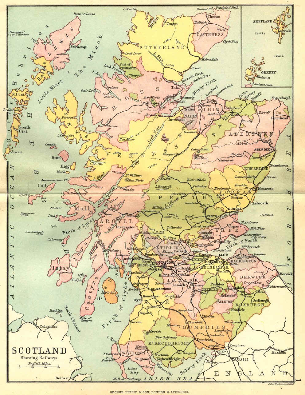
I don’t have much information on him. I believe he may have been born in Lancaster County, Pennsylvania circa 1726. He purchased land from his father’s estate from his siblings—Jacob Hover and Barbara his wife, Henry Shank and Anna his wife, Jacob Boyer and Maria his wife, Elizabeth Hover, Ulrick Hover and Henry Hover all of Pennsylvania—in 1759.1 I had seen the possibility that this John Hoover was also the John Hoover of Necessity, Maryland alluded to on a message board and wanted to see if I could find evidence in the data I’ve acquired.2

So, I was looking at deeds and land patents for John Hoover for leads. John Hoover of Necessity was in Maryland by 1769 when he received a deed for “Harry’s Grove” from the David Watson estate at the request of Michael Miller, to whom it had been sold but who had not received a deed. 3 If John Hoover of Necessity was the son of Ulrich Hoover of Conestoga Township, then he would have had to have sold his Lancaster property at or before 1769.

John Hoover 1744 Martic Township land patent

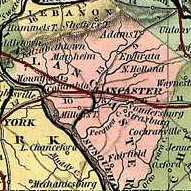
John Hoover 1744 Martic Twp land patent

I did not find any deeds for John Hoover selling land in Conestoga (now Pequea) Township. I found a deed for John Hoover purchasing land in Conestoga Township. On 28 May 1754, John Hoover purchased 110 acres on Pequea Creek from Jacob Eshleman and Pebela his wife.4 There were several land patents for John Hoover in the same general area—one for 105 acres adjoining Ulrich Hoover’s tract in Martic (now Providence) and Conestoga Townships and another for 25 acres in Conestoga Township.

Figuring the land adjoining Ulrich’s was the best bet, I followed up on that first. This tract—although patented to John Hoober—had first been the land of Jacob and Barbara (___) Hoober from Martin Kendig. 5,6 It was sold by John’s heirs—Jacob Hoover and Margaret his wife, John Hoover, Henry Hoover and Mary his wife, Christian Hoover, Peter Hoover, Anna Brenneman, Frena Hoover, and Barbara Hoover all of Lancaster County—to their brother Abraham Hoover in 1785.7 So, this may not be the John Hoover I’m looking for.

John Hoover 1752 Conestoga Township land patent

John Hoover 1752 Conestoga twp land patent

Next I looked at the land patent for the 25 acres in Conestoga Township patented to John Hoover in 1752.8 Looking at the survey, I was confused. I saw no reference to it being for John Hoover. This tract was apparently patented to Michael Hess in 1744. Had I made a mistake? I double checked the index and looked the survey up again on the internet. No, that was the correct file.

I spent some time pouring over the Township Warrantee maps, but couldn’t find matching land for John Hoover, Jacob Good or Jacob Rubely. I found Michael Hess, but it wasn’t matching up.

So, I looked up the survey for the adjoining land of Jacob Good. 9 It made no reference to Jacob Good, but instead showed the land as patented to Thomas Lindley. Now I was still confused, however the name Lindley rang a bell.

Jacob Eshleman Conestoga Township tract

Jacob Eshleman Conestoga Twp tract

The land John Hoover purchased from Jacob Eshleman bordered on land of Thomas Lindley. Figuring that John Hoover’s property bordered on this land, I compared the description of the tract borders from the deed to the survey to see where they met. To my surprise, they matched! And moreover, not only was this Lindley tract the same property patented Jacob Eshlemen in 1744 and sold to John Hoover in 1754, but it also abutted the property allegedly patented to John Hoover in 1752.

Now I knew that I had the correct pieces of property. So, I printed off the surveys for both tracts. Each survey comes with two pages, the survey drawing and information and the reverse page that usually gives the date, location and patentee name. Looking at the reverse pages of these two surveys, I saw that they clearly stated that the patent surveys were for “John Hoover in Right of Michael Hess” and “for the use of Jacob Ashleman.” The moral here: examine the whole document before freaking out!

So, I still don’t know if Ulrich’s son John Hoover is the John Hoover of Necessity—that will take much more work. I don’t even know if these documents belong to John2 Hoover (Ulrich1). However, I have, I believe, tied these three documents—the two patents and the deed—together. It is highly likely that John Hoover of Conestoga Township, having patented 25 acres in the township in 1752, purchased the adjoining land from Jacob Eshleman in 1754.

Now I need to find out what happened to this property. Did he sell it or was it passed down to one of his children?

If you have any information on these families, please I’d love to see it!

The Internet Is Only the Start…

There’s an excellent article in the Broomfield Enterprise by Julie Miller—“Internet is resource, but not do-all genealogy tool.” She makes the argument that the internet is not the be all, end all genealogy resource, that if you only look at records online, you’ll miss the majority of your family history story. This point is all too easy to overlook in today’s online world.

There is so much more information available online today than there was even 10+ years ago when I started out. It’s so easy to focus only on what’s available online, because let’s face it you can learn a lot and the convenience is amazing! But as a family historian you need to also face up to two facts: 1) the information on the internet is only the tip of the iceberg and 2) much of what you find online is either incomplete or sometimes even wrong.

The offline world has probate records, deed records, tax records, town/county histories, church records, vital records, cemetery records, etc.—most of which you will not find online. If you skip these sources, you will miss out on a lot of information. Not to mention you’ll miss out on the thrill of the hunt and the absolute joy of finding that bit of information that puts your family history puzzle together!

Relying on GEDCOMs or family trees that others have put together online is also a mistake—especially if they don’t have sources or if their sources are only someone else’s work! Locating primary and secondary sources is the only way to verify someone else’s work and is absolutely necessary if it’s at all important to you to make the correct connections in your family tree. Mistakes are common, so do the work and think for yourself.

Take some time to visit genealogical and historical societies in the locale you’re researching. Visit courthouses, churches and cemeteries. And if you can’t get there in person, try something really old-fashioned—the mail. You’ll be amazed at what you can learn.

Lancaster Deed Book Index

I’ve written about how much I love deeds—and the great information you can find in them—and I’ve written about how great it is to find the Lancaster County Deed books viewable online. One thing that’s not so great is not having a deed index online, too.

I’m working on changing that! I’ve been going through the books and creating an index that I hope to share through my site. It started out containing the information found in the Grantor and Grantee indices that were created in book form—the standard grantor information, grantee information, book, volume, page number, deed date, date recorded, and location or type of record (mortgage, quitclaim, etc.) All the necessary information to find the deed you’re looking for.

But then I started thinking about what would be included in my ideal index. Here are some of the ideas I came up with:

  • Image Frame Number
  • The page number and frame number don’t correspond—and can be quite off—and the page numbers can sometimes be impossible to read.
  • Grantor/Grantee Location
  • Sometimes it’s hard to distinguish between multiple men of the same name without a residence or occupation.
  • Spouse Name
  • For land sales, sometimes the wife is named. This also helps to identify the grantor among men of the same name.
  • Neighbors
  • Often deeds refer to the owners of adjoining property. This might help to locate an individual where others records don’t exist or can’t be found.
  • Others Named
  • There are also other people associated with a deed: witnesses, previous owners, family members when a deed is part of an estate settlement, etc. This may help to locate people who otherwise wouldn’t be found, especially where an earlier deed wasn’t recorded.

What would you like to see in your ideal deed index? Drop me a line or leave a comment and let me know. You just might see it in the final product!

Don’t Forget Deeds!

Have I mentioned I love deeds? Well, even if I have, it bears repeating. I LOVE deeds! As I’ve mentioned before I’m gathering information on the Hoover/Huber families of Lancaster County. I’m currently reviewing deed records for these families and abstracting them with the ultimate goal of creating a volume of Lancaster County Huber/Hoover family data.

You wouldn’t believe the amount of information in some of these deeds. True enough, some of the deeds are simply—so & so Hoover sold or bought from so & so x amount of land in xyz township, bounded as follows… But some of the deeds list the land transactions for that piece of property back to the original grant from the Proprietaries of Pennsylvania, including references to the original patent (patent book, volume & page) and other deed transactions. They also name each owner and their wife and sometimes—as land was often transferred through families—children and their spouses. I’ve even come across deeds created during an estate settlement that include verbatim extractions from the will itself.

As I’ve been going through the deeds I’ve been keeping a list of persons and their locations, including their heirs as taken from the deed, and trying to make connections between persons. For some reason, I’ve become stuck for the moment on Christian Huber/Hoober/Hoover of Hempfield Township. One deed listed his heirs:1

  • Martin Hoover of Hempfield Township, wife Catharine
  • Jacob Hoover of Brecknock Township, wife Anna
  • Elizabeth (Hoover) Funk of Manor Township, husband Henry
  • John Hoover of Hempfield Township
  • Barbara Hoover
  • Magdalena Hoover
  • Anna Hoover
  • Michael Hoover
  • Christian Hoover Jr.

Later deeds reveal that Barbara Hoover married Christian Hoffman bet 1758 and 1764, Magdalena Hoover married John Hershey bet 1758 and 1767, and Anna Hoover married John Bossler (also Bassler, Basler, Bausler) between 1758 and 1769.2  Michael and Christian Hoover Jr. both died after their father in their minority without issue. Other deeds showed that John Hoover married Anna (possibly Hershey) and was a miller. He was also likely the John Hoover Esq. who was the executor of the estate of Johannes Hoover of Manheim Township.3

John Hoover Esq. and his wife Anna, according to his will, had children:

  • Elizabeth Hoover, wife of Peter Baughman (also Bachman, Bauchman)
  • Christian Hoover
  • Mary Hoover, wife of Jacob Stehman

Another daughter, Ann Hoover wife of Christian Stehman, although not named in the will abstract, is named in a deed where the heirs sign a release for property in Manheim Township that John left his daughter Elizabeth and her husband Peter Baughman.4 If I’d hadn’t found this deed, I wouldn’t have known about Ann.

I’ve also had success tracing Peter Baughman’s ancestry and other relatives through deeds. His brother Christian died without issue and there are deeds that name his siblings, some of their children, and in a couple of cases grandchildren. Deeds also provided the name of the son-in-law of Peter’s sister Ann (Baughman) Bear. Want to guess? Ann’s daughter Catharine married a Christian Huber. Think there’s a connection back to Christian Hoover of Hempfield? I don’t know, but maybe the deeds will tell us…

So, don’t discount deeds. They can be a veritable gold mine of information, especially when use in conjunction with other sources. Have you learned something valuable by researching deeds? Please share.

Huber/Hoover Map of Lancaster County, PA

I’m in the middle project on the Huber/Hoover family, specifically looking at Lancaster County and Fayette County, Pennsylvania and Washington County, Maryland—with the likelihood of branching out to additional areas like Somerset County, Bedford County, Franklin County, Dauphin County… A big undertaking!

I’ve started by looking at deeds and land warrants for Lancaster County. Being a visual person, I wanted some way of seeing spatial relationship between the locations from these records. I tried combining data from the warrantee township maps, but decided to try a simpler approach.

I put together a map of the original townships of Lancaster County that were within its current boundaries. Lancaster originally included much more land, including parts of Dauphin, Lebanon, Berks, Cumberland, York, Adams and Franklin counties. For my purposes I wanted to focus on a smaller area. On this map I plotted the approximate locations of Huber/Hoover tracts from the land warrants prior to 1800.

Lancaster County Huber/Hoover land warrant tracts

I can’t guarantee that I’ve got everyone correct. John Jacob and Jacob Huber in Conestoga (now Pequea) could have been the same man. The two tracts adjoin. Since the patents were for John Jacob Huber (from Martin Kendig, 1736) and Jacob Huber (from John Smith, 1759), I indicated them separately.

Also, I haven’t determined if all the tracts in Warwick and Manheim Townships were to the same Jacob Huber. Jacob Huber (ca 1708-1767), the founder and ironmaster of Elizabeth Furnace, did own substantial amounts of property. So, it is likely the same man.

I must caution that proximity does NOT necessarily always indicate a relationship. According to Harry Hoover’s book on the descendants of Hans Hoober of Earl Township, Hans’ son Jacob owned property in Martic Township—he was likely the John Jacob Huber—quite a ways away from his father’s land. Hans and Martin of Earl Township are, however, grandfather and grandson.